Reality capture services in Manchester
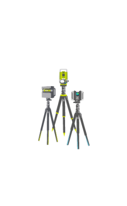 3D Laser Scanning in Manchester
Discover the capabilities of 3D laser scanning solutions in Manchester, where precision intersects with innovation. Whether you’re capturing intricate data of established structures, conducting thorough analysis, or crafting impressive renovation models, our solutions assure incomparable accuracy, comprehensive coverage, and enduring reliability. Enhance your operational efficiency and cost-effectiveness with the transformative impact of 3D laser scanning, redefining your production processes and maintaining meticulous quality control throughout. Unleash the full potential of your projects with our 3D laser scanning solutions, designed to meet the demands of the modern era.
Read more
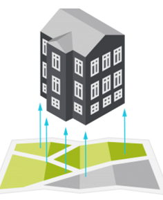 Scan-To-BIM in Manchester
Our Scan-to-BIM service in Manchester, transforms raw data seamlessly into sophisticated 3D models, fostering the creation of a digital twin for your asset. This transformative journey enables versatile models to use for planning, development, monitoring, and asset management purposes. Encompassing both Architectural BIM modelling and MEP BIM Modelling, our service ensures a well-rounded approach to fulfilling your project demands. Leveraging advanced technology and adept expertise, we provide you with indispensable tools to optimise efficiency, accuracy, and decision-making throughout your asset’s lifecycle.
Read more
 Model Validation in Manchester
Experience a paradigm shift in construction verification with the incorporation of Artificial Intelligence (AI) technology. Our system employs model validation AI and machine learning to autonomously analyse and cross-check site survey data with the BIM model. This progressive approach significantly speeds up the verification process, delivering vital insights in a fraction of the time required by traditional methods. Through the integration of AI technology, we simplify verification protocols, enabling prompt evaluation and minimising potential risks arising from inconsistencies between site conditions and the BIM model. Embracing model validation facilitates efficient project management and elevates project outcomes, culminating in enhanced success and stakeholder satisfaction.
Read more
360° Progress Monitoring in Manchester
Embark on a journey of innovation in construction project oversight with 360° Progress Monitoring, reshaping record-keeping, communication, and transparency. Access detailed, high-resolution photos and visual data during critical build stages, facilitating comprehensive monitoring throughout the project lifecycle. Seamlessly accessible via a cloud-based platform, this information streamlines collaboration and empowers informed decision-making. From architects to investors, real-time insights empower stakeholders, fostering trust and synergy within project teams. Rely on our solution to deliver unparalleled progress monitoring for your Manchester-based projects. Elevate your project monitoring capabilities, ensuring successful outcomes characterised by enhanced efficiency and transparency.
Read more
Matterport Virtual Tours in Manchester
Immerse yourself in a virtual adventure with our cutting-edge 360° Virtual Tour experience, using Matterport technology. Delve into interactive dollhouse views, detailed floor plans, venue information, and a suite of intelligent features. These virtual tours not only captivate digital audiences but also markedly enhance engagement, driving sales to new heights. Serving as invaluable records, they chronicle key milestones throughout the journey. Embrace this innovative approach to expand the reach of your space, captivating a broader audience and spotlighting its unique attributes in exquisite detail. Rely on our solution to elevate your digital presence, providing unforgettable experiences and propelling success in your ventures.
Read more
 Drone Surveys in Manchester
Harnessing unmanned aerial vehicles (UAVs), commonly known as drones, fitted with advanced sensors allows for data capture from diverse viewpoints. Drone survey technology excels in mapping complex or difficult terrains, enabling the generation of intricately detailed models of sites or structures in Manchester. Drone surveys, also known as aerial surveys, efficiently capture your site with remarkable precision, placing emphasis on speed, safety, and efficiency. By embracing this state-of-the-art methodology, you acquire swift and precise insights into your project, bolstering decision-making and optimising workflows. Place your trust in our drone survey services to deliver unmatched results, ensuring the smooth progression of your project with accuracy and effectiveness.
Read more
 Topographical Surveys in Manchester
Fundamental to construction and development ventures, topographical surveys offer indispensable insights pivotal for design, project planning, and comprehension. ScanTech Digital offers cost-effective topographical surveys in Manchester, catering to architects, main contractors, property developers, and asset owners. Our detailed surveys, encompassing traditional 2D, 3D CAD, or site 3D models, ensure clarity, mitigate risks, and simplify setting out, spot levels, and site controls. Leveraging LiDAR scanners, we generate intricate models, revealing objects below the surface, mapping utilities, delineating flood plains, and uncovering concealed elements, augmenting project accuracy and efficiency.
Read more